Hi, we are looking for an image processing engineer intern who is not afraid of deep learning with remote sensing images.
Super-resolution offers great prospects in many fields, including in remote sensing. However, very few studies focus on the usefulness of the technique. In particular, does super-resolution helps with landcover mapping, like semantic segmentation or pixel wise patch-based classification? We already have plenty of state of the art methods to extract information automatically from remote sensing image for earth observation. Now, could we apply these great tools on images generated with super-resolution and benefit from the learnt transform from low resolution to high resolution images? Those are quite interesting questions that we are actively trying to answer at the TETIS lab.
Context
Today, many satellite missions continuously collect remote sensing data describing the Earth’s surface at different spatial and temporal resolutions. Therefore, a single study area can be covered by heterogeneous and multimodal information. This information is of paramount importance for monitoring spatio-temporal phenomena and producing land use maps to facilitate sustainable agriculture, monitoring of artificialization and public policy decisions. In recent years, the remote sensing research community has focused on the use of deep-learning approaches. These approaches allow the integration of complementary sensor acquisitions available over the same study area, with the aim of exploiting the interaction between sources with different spectral and spatial contents. The goal is to improve land cover mapping by taking advantage of all available imagery sources. Among those techniques, super-resolution enables to increase the spatial resolution of satellite images. Deep-learning methods such as Generative Adversarial Networks (GAN) or other approaches based on carefully taylored losses are more and more used on geospatial images.
Environment
The internship is part of a research collaboration with our partner, the company GEOFIT.

Objective
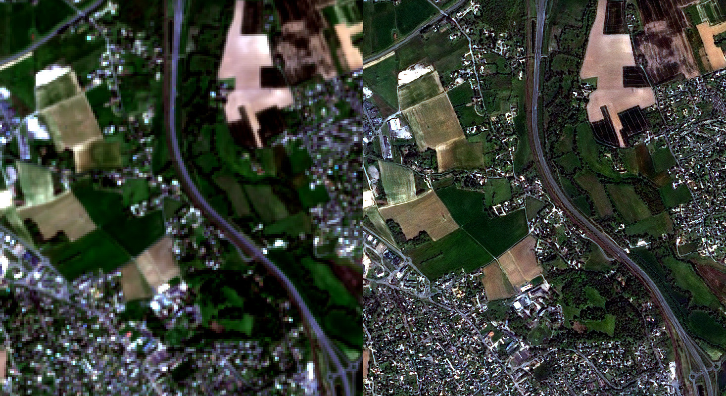
The objective of the internship is to characterize the potential of the super-resolution of Sentinel-2 optical images (13 spectral bands covering the visible to near/mid visible – at 10m spacing) from very high resolution Spot-6/7 optical images ( 1 panchromatic channel at 1.5m spacing and 4 spectral bands Red, Blue, Green and Near Infrared at 6m spacing) for pixel wise image classification.
In particular, the mission of the recruited person will be:
- A bibliographic study of state-of-the-art methods in deep learning, in the field of remote sensing, for the spatial super-resolution task,
- The construction of a dataset of Sentinel-2 and Spot-6/7 images,
- The choice of two complementary super-resolution methods, their implementation and their application on the previously built dataset,
- The evaluation of the results of the implemented methods and their comparison using metrics to estimate the quality of the reconstructed images,
- The evaluation of the results obtained with the implemented super-resolution methods in the context of a supervised classification application of satellite images on a land use mapping and/or artificial surface classification task.
Keywords
deep-learning, remote-sensing, super-resolution, landcover-maping, linux, python, TensorFlow, Orfeo ToolBox, GDAL, GPU
Skills
- Master degree
- Knowledge of python and linux
- First experience with TensorFlow, Keras, or PyTorch
- Background in signal or image processing
- Some skills in remote sensing would be appreciated
- Good reading level in English
The internship
- Start: March or April 2022
- Location: Montpellier, France, Earth
- Duration: 6 months
- Salary: approx. 550€ per month
Contacts
- Dino Ienco (dino dot ienco at inrae.fr)
- Remi Cresson (remi dot cresson at inrae.fr)
- Philippe Albert (p dot albert at geofit.fr)